
The recording year ahead – 2025
2025 is well under way and the website has been updated to include some of the changes in the way we record plants in Sussex.
On the Introduction to Recording page there is an updated version of our Recording Guidelines and a link to the latest version of the ERC (Excel Recording Card). We prefer recorders to use iRecord rather than the ERC, but older members who have been using the ERC for many years may prefer to continue using this method. It should be noted, however, that one can use iRecord in very similar way if you upload your records at home: simply log into iRecord on your computer and add a list of species for a location that you define. You can even use three-letter abbreviations for genus and species.
iRecord users who are SBRS members can choose to join in the Activities set up for recorders in each of the Vice-counties. This doesn’t make any difference in terms of where your records end up (they all go to the BSBI and Sussex Biodiversity Recording Centre when verified as correct), but it allows you to see who else has been recording, what they’ve been recording and access to photographs that people have added to iRecord. Hopefully this will create a sense of community amongst plant recorders across the counties.
The big change this year is that we will no longer accept records submitted with grid references at tetrad level. This mainly affects users of the ERC, but iRecord users who use the Plant Survery or Species List Survey options on the app when recording in the field will need to ensure they switch the Grid Square Unit in Settings to monad (see below).
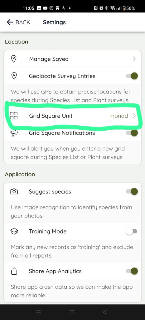
The lowest resolution of grid reference is now the monad (1km x 1km square on the Ordnance Survey map). These appear as two letters followed by four digits. e.g. TQ3941
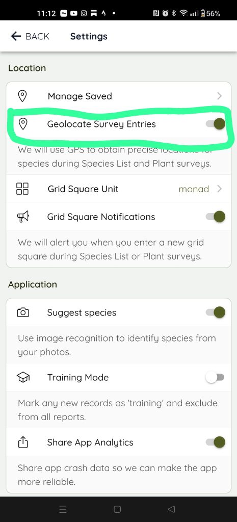
If you use the iRecord app to record in the field and in the settings you have switched on the Geolocate Survey Entries toggle button (see below), then the app will invariably record a more detailed grid reference each time you enter a new record. If unable to obtain a satellite location it will just use the monad information given when setting up the Survey. (Note: you have to have the Location function on your phone switched on to allow the phone to use satellite location data.)
If anyone has any difficulty using iRecord then Ruth Eastwood and Nevil Hutchinson are happy to help. Just get in touch by email using w_sussex_recorder@sussexflora.org.uk or e_sussex_recorder@sussexflora.org.uk respectively.